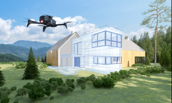
A new all-in-one aerial imagery and 3D modeling system helps simplify the process of capturing aerial photographs.
Retailing for $1,099, the Parrot Bebop-Pro 3D Modeling pack includes a Parrot Bebop 2 drone with Parrot Skycontroller 2 remote control, Pix4Dcapture app to automatically take aerial images as well as Pix4Dmodel software to process images and create a 3D model.
The system can help builders and real estate professionals develop innovative marketing content such as commercial videos and 3D interactive models, or capture measurements for cost estimates or 3D model printing, the firm says. Ultra-compact and lightweight for easy portability, it can be piloted easily via wi-fi with a smartphone/tablet or with the Parrot Skycontroller 2, a dedicated remote control which extends the range up to 2 kilometers.
Once the user defines the area to map on the smartphone/tablet screen, the app creates an optimized flight plan. In about ten minutes, Parrot Bebop 2 flies over the predetermined zone to collect images and data autonomously. In 30 minutes, the images and data are analyzed and converted into a realistic 3D model thanks to Pix4Dmodel image processing software, says the firm. It offers 25 minutes of flight time.